
 * Where did the Pacific's Continental Crust Go? For this sixth program in our continuing series, RSR's List of Answers to Hydroplate Theory Objections (see rsr.org/answers), Bob Enyart again interviews Kevin Lea, HPT expert and graduate of the U.S. Naval Nuclear Power Program, to discuss the "Missing Pacific Crust" objection to Dr. Walt Brown's Hydroplate Theory. In 2012 renowned geophysicist and creationist John Baumgardner objected to the HPT's "claim that a layer of buoyant granitic crust currently lies beneath the Pacific basin. ...continental crust is readily distinguished from mantle rock by modern seismic techniques." Dr. Baumgardner added that there was an "unmistakable absence of any thick layer of granitic crust in the Pacific basin." However, Lea and Enyart share the discoveries beneath the Pacific and Indian Oceans of many researchers, as published in the scientific literature, documenting the extensive "presence of continental-type crust in the oceans where oceanic crust might be expected [which] has been recognized from seismic information by a number of authors." (For more information, see rsr.org/albright and rsr.org/hpt.
* 2017 Show Update: More Sunken Continental Crust! Remember, all scientists work for Walt Brown. In this case, the Geological Society of America published in their peer-reviewed journal GSA Today that a 4.9 million square kilometer of "the southwest Pacific Ocean is made up of continental crust." 94% of that continental mass, dubbed Zealandia, is submerged. (See GSA's Flip PDF.)

As Walt Brown describes it, "Because the Pacific crust would not have dropped as 'one huge block' (as early geologists thought), its thousands of fragments, buried under and within the magma that rose to the surface, will be difficult to detect seismically. However, the largest block, greater in area than India, is now recognized as a 94% submerged continent called, Zealandia."
In Feb. 2020 the journal Geology reported Continental-scale geographic change across Zealandia during Paleogene subduction initiation. (Actually, that shouldn't say subduction, but subsidence. And the discovery of dinosaur blood proved scientifically that the geologic column does not represent millions of years but that a single recent global flood produced its sediments, strata, and fossils. So the million-year timeframes are invalid in the otherwise important Zealandia research.) About this, Christopher Carbone at Fox News reported in 'Lost continent' of Zealandia transformed by formation of the Pacific’s Ring of Fire:
The 'lost continent' of Zealandia, which is submerged beneath the Pacific Ocean, experienced a major upheaval...
...scientists now believe that the topographic transformation may have been related to a reactivation of ancient fault lines linked to the formation of the western Pacific's Ring of Fire.
Their timeframes are all wrong, so there were no "ancient" fractures to reactivate.
Scientists have long believed that Zealandia's crust began to thin...
Long? Remember, all scientists work for Walt Brown! And Zealandia was discovered and named only in 1995.
"These dramatic changes in northern Zealandia, an area about the size of India, coincided with buckling of rock layers (known as strata) and the formation of underwater volcanoes throughout the western Pacific," study co-authors Rupert Sutherland, a geophysicist at Te Herenga Waka-Victoria University of Wellington, and Gerald Dickens, of Rice University in Texas, wrote in The Conversation.
“One of the amazing things about our observations is that they reveal the early signs of the Ring of Fire were almost simultaneous throughout the western Pacific,” Sutherland said in a Geological Society of America press statement.
Sutherland and his colleagues have put forth a new mechanism: a so-called "subduction rupture event", which they compare to a massive, super-slow earthquake.
Actually, during the flood's continental drift phase (which is after its rupture and flood phases and before it's recovery phase) is when Zealandia began to sink. See the HPT's Sequence of Events at rsr.org/sequence.
“We don’t know where or why,” said Sutherland, “but something happened that locally induced movement, and when the fault started to slip, like in an earthquake the motion rapidly spread sideways onto adjacent parts of the fault system and then around the western Pacific.”
* Today's Resource: To order RSR's #1 best-selling video (although our big bang video is catching up!), just click...
The Global Flood and the Hydroplate Theory
Blu-ray, 2-DVD Set, Stream or HD Download!
* See RSR's COMPLETE Global Flood and Hydroplate Theory: New in 2018, we've made available online for free our full, best-selling flood video. (Also available on DVD & Blu-ray for sharing with friends. And to help underwrite making this more widely available, please consider a donation. Thanks so much!) We hope you enjoy this:
* Flood Video Menu Contents: Real Science Radio co-host Bob Enyart presents the scientific evidence for Dr. Walt Brown’s model of the global flood, along with the relevant biblical material. Enyart also discusses Brown's opponents and contrasts both the vapor canopy and catastrophic plate tectonics with the hydroplate theory.
DVD Vol. 1
1. Walt Brown, Creation Leaders, and Scripture
2. Hydroplate Theory & Scientific Evidence
DVD Vol. 2
3. Hydroplates vs. Plate Tectonics
Bonus: Origin of Earth's Radioactivity
The Blu-ray disc contains all parts on one disc.
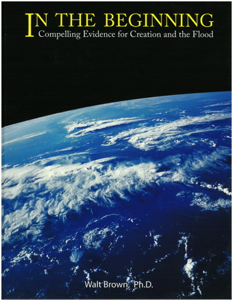
* Get the Best Creation Science Book Ever Written: Just click on the cover of the book to purchase it from RSR (which also helps us to continue broadcasting)...
* Hydroplate Theory Observations: From Dr. Brown's book, consider these observations and questions:
- that the continents do not fit together well against each other, as presented in the Pangaea hypothesis, unless you shrink Africa by 30%, and make other unjustified manipulations.
- that the jigsaw shape of the continents does fit well against the Mid-Atlantic Ridge.
- what formed the 46,000-mile long Mid-oceanic Ridge?
- that the Atlantic Ocean is relatively shallow, whereas the Pacific is relatively deep.
- what formed the deep Pacific trenches including the 36-thousand foot-deep Marianas Trench.
- that the fountains of the great deep launched the solar system's asteroids and comets.
- that Mars is not the source of Antarctica meteorites, but they were launched from Earth.
- that the debris launched from the Earth beat up the moon, which helps to explain why the near-side has suffered much greater impactors.
- that NASA discovered the Earth-like composition of comets, including that they contain olivine, a very common class of Earth minerals, confirming an inherent prediction of Dr. Walt Brown's flood model.
- that NASA found salt on the asteroid Ceres!
* RSR Flood Model Resources including Shared Google Spreadsheets:
- Bible Material Uniquely Supporting Various Flood Models
- Physical Features Requiring Explanation and Flood Models
- HPT Confirmed Predictions here at rsr.org/predictions#walt-brown
- All of Real Science Radio's HPT resources collected over at rsr.org/global-flood.